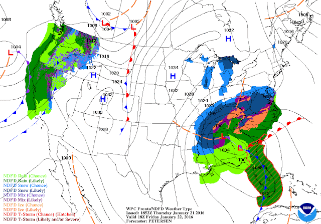
As you've probably been aware, tomorrow we will have a significant snow system move through the entire state of Kentucky. A Winter Storm Warning has already been issued for our region. Setting up to effect most of the Eastern U.S., Winter Storm 'Jonas' will bring almost every threat one can think of: snow, sleet, a little freezing rain, etc:
Notice how there is a significant mix/ice threat near southern KY around noon tomorrow. This system not only gives us a great amount of snow, but throws a significant icing threat around the Bowling Green region. Thus, some power outages are not out of the picture, so please take caution!!
Expect this event to begin in the early AM hours tomorrow morning (1-4 AM seems like a good bet).
Snow totals should be anywhere from 8-12 inches for the Bowling Green metro... localized areas could even see more than a foot. Be weary of wind gusts, as they could reach up to 30 mph at times. Here is a great graphic from NWS Louisville regarding their thoughts:
I encourage everyone to have an emergency kit already made. Batteries, flashlights, canned food, blankets, and extra cash are smart to have. Charge your accessories as well, one can never be too careful!!
Have a good one.
James Bryant


No comments:
Post a Comment