EMERGENCY Fall Missing!! Where's Fall?

Attention citizens of South Central KY Fall (the season that is usually colorful and colder) has disappeared and seems no where to be found. Today tied the record of 80℉ for the 17th of November set all the way back in 1958! It certainly has not felt like fall this week, sure we have had couple of cold shots, but nothing compared with the cold we should be feeling in the month of November.

Will there be a change to a more seasonal pattern anytime soon, helping to relieve our drought? My friends it does indeed look like there will be hope for us after all. A very potent cold front looks to sweep through us Friday evening.

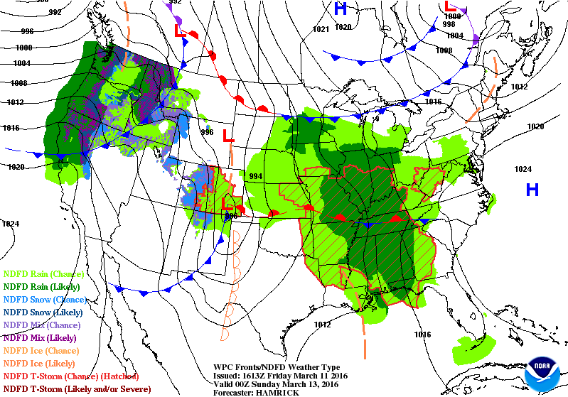
Figure 1: 12Z GFS 1000-500mb Thickness Valid 06Z Sat Nov. 19th 2016 (Friday Evening) Source: MeteoStar Weather Models

Until then we will have to contend with some more warm days. Clear skies this evening will yield a very quick temperature drop into the mid 40s to low 50s. Tomorrow expect mostly sunny skies accompanied by some very gusty winds of 23-27mph possible. The NWS in Louisville is concerned about the elevated fire weather danger with the strong southerly winds and dry conditions. WKU Storm Team will keep you all updated on the situation should any advisories be put out tomorrow. 

Friday evening the cold front will roll through bringing RAIN (yes, I know it has been a while) to the region. Instability may be good enough to support some isolated rumbles of thunder embedded within the showers. Rainfall amounts will be anywhere 1/4-1/3" across the region. Not exactly a drought quencher but every little bit will help, especially with the ongoing wildfires.

Cooler weather will settle in behind the front on Saturday. Gusty winds up to 23 mph are still possible. Highs will be in the low-mid 40s with upper 40s possible in the western parts of South Central KY. Wind chill will also be a factor making it FEEL like mid 30s in some spots. 

Grab a rain jacket and warm clothes for this next stretch of weather. Looking further into the future it doesn't appear to change much, with many systems lined up out in the Pacific.

Have a great night,

Alex Williams


Tracking The Severe Weather Threat

Good afternoon all,

The storm team is tracking the threat for severe weather this afternoon and evening. Right now the Storm Prediction Center has nearly all of South Central Kentucky in a SLIGHT RISK for severe storms later on today.

 
Storms??? What?!?!?!

That's right. Though the area is experience fair weather right now with temperatures in the mid and upper 80s, it's helping to ripen up the atmosphere for severe development. Oh yeah, and if you can feel the moisture, that's because dew points are right around 70 across the area this afternoon.

The hot and moist atmosphere over Bowling Green will help keep things destabilized for this afternoon as a cold front and thunderstorm complex from Missouri sink southward into our region for this afternoon.


TIMING AND IMPACTS
A few isolated and scattered storms will fire up ahead of a cluster of storms diving in from the northwest. The primary threats are damaging winds and heavy rain, of course lightning will be thrown into the mix. While not impressive, there is a chance for at least a brief isolated tornado.

According to the HRRR forecast model, storms will begin to fire around 1PM, and move through the area between 3PM and 5PM.

With that in mind, definitely have a rain plan ready to go if you have outdoor activities planned this afternoon. For the pool lovers, it'd probably be better to get in the swim time now as opposed to later.

Stay tuned to the storm team on Facebook and Twitter regarding any severe weather this afternoon, and as always, have a good one!
- Chris Reece

Another Round of Severe Weather Possible This Afternoon

We are under the gun again as a Slight Risk of Severe Wearher sets up across our region later on today.

A Slight Risk means scattered severe storms possible. Storms should be short-lived and/or not widespread. A few isolated stronger storms are also possible!


Our local National Weather Service in Louisville Discussion:


...A Complex of Strong/Severe Storms Possible This Evening...

The synoptic pattern late this afternoon features weak shortwave
ridging over the Ohio Valley, downstream of an upper-level trough
pushing into the Northern Plains.  This trough will push through the
Ohio Valley through the period, ushering in a couple chances for
showers and thunderstorms.

We continue to watch convection off to the west of the region.  It
has recently become better organized near the Saint Louis area, with
a strong cold pool noted on radar.  This suggests the convection
will begin to accelerate quicker to the east along the I-64 corridor
this evening.  Currently along the I-64 corridor there exists a
remnant boundary, now lifting north as an effective warm front.  To
the south of this, the airmass has become strongly unstable with
MLCAPEs in excess of 3,000 J/kg in places.  DCAPEs in excess of
1,000 J/kg should continue to lead to efficient cold pool
production.  0-3km shear vectors around 20-30 knots oriented
orthogonal to the convection should help keep it loosely tied to its
cold pool, at least through the next several hours.  We could see
convection develop along the lifting warm front this afternoon, but
this will be fighting ridging aloft and a lack of synoptic forcing
so do not think it will become very organized.  The main severe
threat looks to come with the MCS early this evening.

Basically we are extremely unstable today even more so than yesterday however the spin in the atmosphere is not as impressive with only 20-30 kts of wind shear. 40kts is decent for tornadic storms. We don't quite have that today so the main threat will be damaging winds and some small hail. Flash flooding is also a possibility with the ground already saturated due to previous storms training over the same area repeatedly!


WKU Storm Team will keep you updated as the day unfolds on social media.
Twitter: @wkustormteam
Facebook: WKU Storm Team

Stay safe and stay informed 

-AW

A Threat of DANGEROUS Storms Continue Tonight


Good evening, Bowling Green

It certainly has been a stormy afternoon for most of South Central KY!
We have had reports of a large and dangerous tornado in Muhlenberg KY.

The NWS Louisville calls the threat to continue into the evening as well as a Tornado Watch until 11 PM CDT. The environment is very conducive to tornadoes with plenty of shear and instability for the storms to tap into. All of the storms that have formed near our area have immediately started to rotate giving us a good chance of tornadoes.

Latest from NWS Louisville:

...Forecast Update...
Issued at 520 PM EDT Tue May 10 2016

The severe threat continues across the area this evening. More
discrete cells have pulsed up across west and south central KY. Some
of these cells will have the potential to produce tornadoes in
addition to large hail and damaging winds. Thus, south central KY
has been upgraded to a Tornado Watch through 04Z. (04Z = 11 PM CDT)

Some of the pictures from this severe weather event:

Tornado in Crofton , KY 5:37 CDT


Supercell Thunderstorm Owensboro, KY 5:22 PM CDT near the airport


Here is a video of the Hart Co. KY Tornado 5:47 PM CDT


Here is video of the Mayfield, KY Tornado. Incredible footage!


You can get the latest information from our Social Media pages!

Twitter: @wkustormteam

Facebook: WKU Storm Team


Stay informed and stay safe!

-AW


Good Afternoon Bowling Green,


The Storm Prediction Center has issued an Enhanced Risk of severe weather for our area. This means that numerous severe storms are possible. Some of the possible hazards associated with this risk include but are not limited to:
1. A few tornadoes
2. Several reports of wind damage
3. Damaging hail of 1-2" in diameter


Here is what they have written about our region:

A WELL-DEFINED SHORTWAVE TROUGH CURRENTLY OVER MO/IL WILL CONTINUE
TO TRACK NORTHEASTWARD TODAY ACROSS THE LOWER/MID OH VALLEY.  A
LONG-LIVED CLUSTER OF SHOWERS AND THUNDERSTORMS ARE ASSOCIATED WITH
THIS FEATURE. IT REMAINS UNCLEAR HOW THE CONVECTION IN THIS REGION
WILL EVOLVE DUE TO REMNANT CLOUDS OVER IND/OH/KY AND DELAYED
HEATING.  IT STILL APPEARS LIKELY THAT CLUSTER OF STORMS OVER SRN
IL/WRN KY WILL EVENTUALLY INTENSIFY TO SEVERE LEVELS...THUS HAVE
MAINTAINED THE ENH RISK.  IT ALSO APPEARS LIKELY THAT STORMS WILL
DEVELOP ALONG THE SOUTHERN FRINGE OF THE UPPER SYSTEM ACROSS KY AND
PERHAPS TN WHERE STRONG INSTABILITY WILL BE PRESENT.  WIND FIELDS
THROUGHOUT THIS REGION SUPPORT SUPERCELLULAR STRUCTURES CAPABLE OF
LARGE HAIL...DAMAGING WINDS...AND A TORNADO OR TWO.  IF ACTIVITY CAN
GROW UPSCALE...A MORE ORGANIZED WIND EVENT IS POSSIBLE.


We are also under a severe thunderstorm watch until 7 PM CDT which means conditions are favorable for severe thunderstorm development.

Our atmosphere is extremely unstable any storm that does pop up will likely go severe.

Keep tuned into our twitter and Facebook page for all the current updates on watches and warnings for our area.

Twitter: @wkustormteam
Facebook : WKU Storm Team

Also tune into local media/news channels

I will keep our blog updated as well

Stay informed and stay safe

-AW

A Cool But Sunny Weekend Ahead!


Good Evening Bowling Green,

Hope you got a chance to soak up some rays this afternoon. It certainly was beautiful day with highs topping out in the upper 60s across the region. Earth Day on campus was a blast! Lots of great booths and entertainment all around.

I am sure your all wondering what the weather will be like this weekend and especially for the WKU Red and White Game on Saturday. It should be a cooler one under mostly sunny skies to enjoy the game.


This is all thanks to a high pressure system that will be building into the Ohio Valley Saturday into Sunday. A couple of fairly shallow cumulus clouds are possible. Other than that the skies should stay mostly sunny with highs across the region climbing into the lower 70s in some spots with upper 60s across the board. Winds will stay out of the northeast at 5-10 mph. Saturday evening will be much cooler with lows in the mid 40s to 50! So definitely layer up if you have anywhere to go Saturday evening.

Sunday we catch the return flow of the high pressure which will shift our winds from northeast to the south. This should warm us up quite a bit into the upper 70s to lower 80s. Skies will remain mostly clear with a couple high wispy cirrus clouds in advance of the next storm system.

The start of the work week looks to be a stormy one with a short wave rolling out of the Rockies that will push a cold front southeastward but it will stall out north of us and pop off some showers and thunderstorms in evening. Temperatures will reach the mid to upper 80s during the day.

Mondays Outlook

Stay safe and stay classy BG!
Go TOPS!!

Alex Williams

A Breezy Start to Your Weekend


Good Evening BG Community,

It certainly has been a much nicer day then yesterday was! Rain will not be a problem for us this weekend but winds could get pretty gusty on Saturday.

Synopsis:
A cold front will pass to the north of our area this evening while another disturbance passes to the south of us. Again rain will not be an issue but cloud cover will increase through out the evening keeping our temperatures above freezing. Saturday winds will increase due to a tightening pressure gradient around a Low Pressure system passing through the Great Lakes. Sustained winds will be around 15 mph with gusts ranging from 30-35 mph. Another cold front attached to the low to our north, will swing through the region Saturday night dropping temperatures quickly. A high pressure system will propagate into the region from the south casuing wide spread frost to develop dropping temperatures in some places into the 20s by Sunday morning.


Tonight:
Temperatures Lower 40s
Partly Cloudy
Winds W 5-10

Tomorrow:
Highs Upper 50s
Mostly Sunny
Winds W 10-15 Gusting to 35

Tomorrow Night:
Lows in Lower 30s
Clear
Winds SW 5-15 Gusting to 35


A Rainy and Warm Start to the Work Week


Good evening hope your week has been enjoyable!

Looks like the rain chances will continue through the weekend and into our Monday all thanks to this abnormal weather pattern that we are currently experiencing. A piece of energy from the jet stream will split south off the main flow and act as a boot to kick the low sitting over TX into motion. This motion will cause the cold front dropped across the TN valley to lift Northward as a warm front promoting some shower activity to the north of the front. The warm front should be out of the region by midday on Saturday.


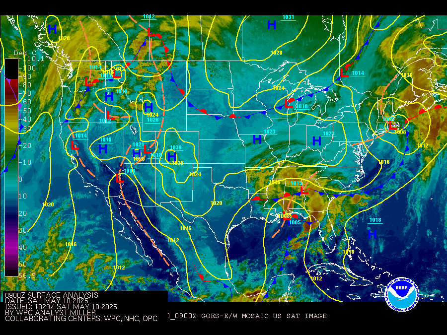
0Z Surface Analysis for Saturday night
Warmer temperatures in the upper 70s and some 80s will be possible as well as some scattered showers mixed with a rumble or two of thunder due to the moist southwesterly wind flow. The same piece of energy that kicked the low out of TX will move into the area Saturday night into Sunday bringing more shower chances into the forecast. Temperatures should remain in the lower 70s Sunday into Monday.


Enjoy your weekend and stay dry!
-Alex Williams


A Warm Start to Your Spring Break!


Good Saturday Morning Springbreakers,

A warmup is on the way for the start of your spring break! A slight chance of rain is possible tomorrow morning as a cold front passes through the area. As the front moves east, sunshine will start to filter in later on in the afternoon. Highs will rise into the 50s across much of the region with the 60 degree mark possible in Bowling Green! A lot nicer than the temps we have had the past couple of days for sure. Temperatures behind the front could drop to near freezing Saturday evening, proof that winter is still in charge at least for the time being.


Synopsis:

A high pressure system will propagate to the east on Sunday helping to pull warmer air into the region. An upper level ridge looks to build over the southeast for the start of the week, causing moisture to stream in just to the west of the region bringing a possibility of rain into our forecast on Tuesday. Timing and placement of this event are still uncertain at this time. Check back with us this week for forecast updates.


Stay safe and have fun,

Alex Williams


A Nice Wednesday, Followed by a Wet Thursday

It was another wet and windy day that featured a prominent temperature drop across south central Kentucky. An area of low pressure tracking through the Ohio Valley brought storms to the region this morning, and is now bringing the wrap around cold, and a few snow flakes to some, as it departs to the north and east.

Behind this, it's high pressure on the map, and that should set things up for a gorgeous, yet much cooler, Wednesday with highs in the mid 40s thanks to a predominantly northern wind flow remaining in place.

By Thursday, the stage is set for another nasty day as an area of low pressure arriving from the north brings a day of rain and a wintry mix to the state. The good news with this is that Bowling Green looks to remain warm enough for all rain, and even if a snow flake were to mix in, the very warm ground would hinder any issues from developing.

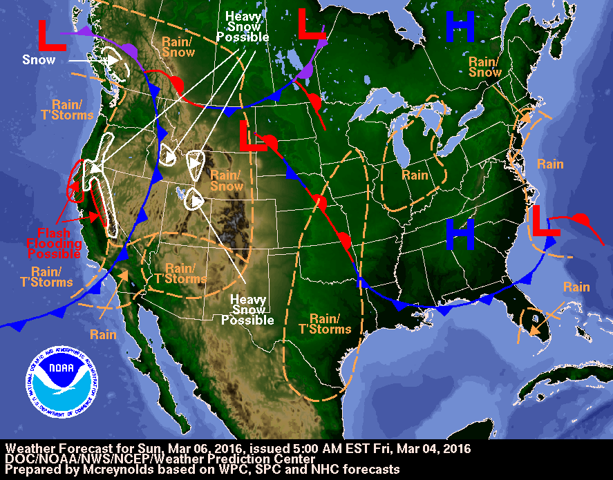
Our friends at the WPC are showing that system in their short range outlook.

Temperatures will spend most of the day in the 40s, so it will be a chilly rain with a nasty feel, but over all highs should top out right around 50 when it is all said and done.

Beyond that, things are looking up for the weekend!

Take care, and stay tuned for Nathan's weekend outlook on Thursday!
- Chris Reece

Sunday Afternoon Update

Good afternoon, folks!

Hopefully everyone has enjoyed this beautiful day so far... we've been in the high-60s all day, and the sunshine has been abundant! As we look around the state, conditions have been pretty similar:
We should stay on the warm side of things for a couple of days (highs in the low-60s) until a trough swings through Tuesday, bringing a good shot at rain and a few storms. A severe weather chance cannot be ruled out with this cold front, especially if we get some sunshine heating up the ground early in the day. This system will make our highs in the mid-40s the following couple of days... spring can't overthrow winter completely just yet, it seems!!

Looking at tonight, we should see winds start to die down slightly, along with clouds beginning to build up. While they indeed bring a slight precipitation chance, these clouds will help keep our low temperatures a little warmer than the seasonal average tonight (45 degrees).

Tomorrow: A tad bit cooler than Sunday. High of 63 degrees; winds remain southwesterly.

Try to appreciate the next 36 hours or so! Get outside and enjoy the awesome weather!
Thanks for reading,
James

A Whole Lot of Nasty Tracking Into Kentucky

It was a day that went from pretty, to pretty ugly in a matter of minutes around here. What started as a day of sunshine quickly became cloud filled and wet. Over the next day and some change there's a whole lot more wet to go, with the addition of thunder, wind, and even some snow thrown into the mix.

This is all thanks to a powerful area of low pressure that is slated to track right on top of the region. That places our neighbors to the northwest in a significant winter storm, and areas to our south in a potent severe weather event. You could argue we get the best of the three, or the worst of the three, with nasty rain and a lot of wind to blow it around.

When the winds get going, you'll know. They'll be pretty breezy with 30 to 40 mph gusts at times. The worst of the wind gusts will be during the morning hours with heavy rain around. Unless you have a very durable umbrella, I'd try a poncho. Tomorrow is very much a day of broken umbrellas for those who aren't careful.  By lunch time, the low will be tracking right over Kentucky. This should bring a break in the action with mostly cloudy skies, though you may see a peek of sunshine or two. Winds will still be gusty, but not as strong, as thermometers spike to near 60. Once the evening rolls around, the rain and wind pick back up again. It's at that point that temperatures should be falling with snow flakes starting to fly later into the night.

Thankfully, the ground is VERY warm, and accumulations, if any, will be held in check to less than an inch....for those who are lucky. Most will see no snow on the ground at all, but will note the flakes flying across the sky.

The accumulations to be concerned about are rainfall amounts. A general 1" - 2" inches of rain is a good bet, which could bring some localized flooding along some creeks and rivers. While it shouldn't be a huge deal by any stretch, we don't want to underestimate it.

All in all, you could call the tomorrow a "meh" day of weather. With snow to the north and severe to the south, conditions around our neck of the woods simply look....nasty.

Thursday looks pretty raw as well. Blustery winds should continue with snow flakes flying, but again, it's not a big deal kind of snow. 

Have a good Wednesday, and remember, hold onto your hats out there! We don't want those blowing around either.

Take care!

Chris Reece


A Hint of Springtime Warmth

Happy Friday to all,
The wind has certainly been howling this afternoon and it was sure nice to see the sun for a little bit today. Temperatures comfortably rose into the mid to upper 60s, even 70s in some spots for much of the region. More of the same is in store for your Saturday with showers and even possibly a few isolated thunderstorms on Sunday.


Big Picture:
A high pressure system off the east coast and a low pressure system over the Great Lakes have put us into southwesterly wind flow, allowing moisture and warmer temperatures to stream into the region. These SW winds will stay around for most of the weekend keeping our temperatures above average for this time of year. A stalled out frontal boundary draped across Illinois and Missouri should keep the rain threat to the south of our region for most of the day tomorrow. 


Developing low pressure to the west will increase our rain chances Saturday night into Sunday with enough warm air still present to produce a rumble of thunder or two. A cold front will sweep through the region Sunday evening bring much cooler temperatures behind it for our Monday.


National Weather Service Louisville, KY Weather Story Graphic

Enjoy the unseasonably warm weather while it still lasts with a return to the upper 40s-lower 50s possible by early next week. 
Have a great weekend,
-Alex Williams


Warmer Weather Blows into Town

Good Thursday evening to all!

We've had periods of cold, snow, and rain over the past several days, which made today's return of sunshine all the more beautiful and lovely. If you liked that, there's a bit more where that came from headed into the start of your weekend.

With high pressure along the east coast, and an area of low pressure in the upper plains, south central Kentucky finds itself in a region of strong southerly wind flow and warming conditions for the weekend.

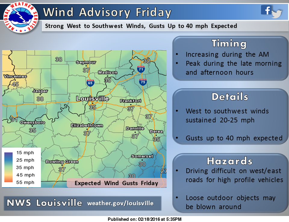
Oh yeah, and a note about the expected winds. They will be VERY gusty. Much of the region should expect south winds of 20 to 25mph, with gusts approaching 40mph at times. This could lead to some travel difficulties for larger vehicles on east to west oriented roads. It is for this reason that a Wind Advisory is in effect through tomorrow evening.


Outside of the wind, the majority of the day will be calm. Sunshine will be noted in the morning, and the warmth will be felt. We're looking at highs in the upper 60s and close to 70 for some! This is all before an increase in clouds during the  afternoon and evening hours. At that point, a few sprinkles may fall headed into the overnight time frame. That's ahead of increasing rain chances by Saturday and into Sunday, but we'll have updates on that tomorrow evening.

For now,  the Friday take away is sunshine in the morning  that will give way to increasing clouds and a few evening sprinkles. Highs will range from roughly 65 to 70 degrees area wide. Lastly, hold on to your hats, or else the wind won't be the only thing blowing around out there.

Have a good one, and enjoy the warmth tomorrow. After all, it's mid February, and winter isn't exactly over. ;)

- Chris Reece

Weekend Outlook: Snowy and Cold!!

Good Evening,

It certainly looks and feels like winter outside, brrrrrr!!! These brutally cold temperatures will continue into your weekend along with snow chances.

Synopsis:

A strong area of high pressure will be moving SE across the upper Midwest pushing colder air into our region this evening. The cold air remains in place for Saturday keeping our temperatures below the freezing mark. Increasing warm air aloft on Sunday will trigger light snow showers across the area while a shortwave crossing the Midwest should help to strengthen them a little. 

Attention shifts toward a developing winter storm to our SW Sunday evening. A large part of the storm should stay to our south as it tracks eastward. Precipitation should stay as snow for the overnight hours Sunday with a transition to drizzle by Monday morning.

Forecast of Fronts/Pressure valid Mon 00Z


Forecast:

Tonight temperatures are expected to drop into the teens with a chance of flurries possible.

Tomorrow and tomorrow night will remain cold, with temperatures ranging only from the teens at night to mid 20s during the day.

The highs for Sunday stay in the lower 30s with light snow showers developing during the day. 

Sunday night will bring the increasing chance of snow possibly mixed with rain and freezing rain. Light accumulations of snow and ice are possible. Lows will hover around 30 degrees.


Monday highs will climb into the lower 40s across the area with rain mixing at times with snow throughout the day.

Image of Central KY/Southern IN Forecast Snowfall Amounts for the Next 3 DaysImage of Central KY/Southern IN Forecast Ice Amounts for the Next 3 Days


 If you have to travel this weekend, be sure to exercise caution while driving as roads could become slick if they become coated with snow and ice! 

Stay safe and have a great weekend!
Alex Williams

Cold and Snow Chances Continue

Good Tuesday evening everyone!

 Hope you all were able to keep warm throughout the day. The chances of snow and cold will persist over the next few day thanks to the arctic airmass over our region. 


An area of low pressure over Lake Erie has placed south central Kentucky in a northwest flow. The area of low pressure combining with an upper level disturbance passing by has allowed for colder temperatures and the snow we have had, which will be off and on the rest of the night. 

Snow hasn't really been the big issue, however flash freezing has been occurring in spots and was responsible for my tumble last night. Drive with caution on secondary roadways, especially if they haven't been treated. In addition, a Winter Weather Advisory is still in effect for much of the area until 9 AM tomorrow morning. 

It will be a cold night, regardless if it's snowing or not. Wednesday morning wind chills will hover near 0, thus if you're heading out in the morning like I will be, you need to bundle up.


By tomorrow, snow showers should start to diminish as the main northwesterly flow heads towards the northeast. As that pushes off, attention turns to  a clipper system, which will approach from the north and west.


Forecast guidance indicated that this will be a weakening clipper system that shouldn't bring much in the way of accumulations, but nonetheless, flakes will fall Wednesday night and into Thursday. 


Beyond that, there could be additional light snow disturbances, but those will be looked at more closely in the next blog post.


In the mean time, stay warm, and make sure to check back with the WKU Storm Team for further updates. 


Have a goodnight!
Nathan Crowdus

When and What to Expect For Winter Storm Jonas

Hello, everyone!

As you've probably been aware, tomorrow we will have a significant snow system move through the entire state of Kentucky. A Winter Storm Warning has already been issued for our region. Setting up to effect most of the Eastern U.S., Winter Storm 'Jonas' will bring almost every threat one can think of: snow, sleet, a little freezing rain, etc:

Notice how there is a significant mix/ice threat near southern KY around noon tomorrow. This system not only gives us a great amount of snow, but throws a significant icing threat around the Bowling Green region. Thus, some power outages are not out of the picture, so please take caution!!

Expect this event to begin in the early AM hours tomorrow morning (1-4 AM seems like a good bet).
Snow totals should be anywhere from 8-12 inches for the Bowling Green metro... localized areas could even see more than a foot. Be weary of wind gusts, as they could reach up to 30 mph at times. Here is a great graphic from NWS Louisville regarding their thoughts:


I encourage everyone to have an emergency kit already made. Batteries, flashlights, canned food, blankets, and extra cash are smart to have. Charge your accessories as well, one can never be too careful!!

Have a good one.
James Bryant

Mostly Sunny & Not as Cold

Today was beautiful but a bit cool in south central Kentucky.  The official high temperature in Bowling Green was 52°, which is only about 4° below average. However, this morning started off at a chilly 22°, which is 13° below normal.

Tomorrow will be a bit warmer starting off right around 30° and warming into the mid 50s. A mild warming trend will then continue through Thanksgiving. Our next rain chance won’t arrive until Friday. So, it’s just a mix of sun and clouds until then.

Forecasted temperatures for 3:00PM CST on Tuesday, November 24th courtesy of the National Weather Service
Forecast:

Tonight:  Mostly clear, lows near 30°, and light winds out of the SSW.

Tomorrow:  Mostly sunny, highs near 56°, and winds out of the south at around 3-6 mph.

Tomorrow Night:  Partly cloudy, lows near 35°, and light winds out of the southeast.

Thanks for reading, and have a great night!
-Arden Gregory

Rain Possible Again Tomorrow

Today was a cool and cloudy day, and tomorrow will be very similar. Scattered rain showers will be possible, mainly late tonight into early tomorrow morning.  Then, another round of showers as well as thunderstorms will arrive late tomorrow night as we head into Wednesday.

Thanks to a southeasterly flow, temperatures are going to be rather mild. Overnight lows will be right around 50°, which isn’t much of a drop since current temperatures are already in the low 50s.  Tomorrow temperatures will be reaching as high as the upper 60s. Our normal high temperature is 59°.

Forecasted surface conditions for noon on Tuesday, November 16th courtesy of the Weather Prediction Center.
Looking further ahead, a cold front will sweep through during the day on Wednesday and bring our highest chance of showers and thunderstorms. After that passes, our temperatures will begin a slow descent that will begin on Thursday and continue into next week.

Forecast:

Tonight:  Cloudy skies, a 60% chance of scattered showers, lows near 50°, and winds out of the southeast at around 4-8 mph.

Tomorrow:  Cloudy skies, a 40% chance of scattered showers, mainly in the AM, highs near 68°, and winds out of the southeast at around 10-15 mph.

Tomorrow Night:  Cloudy skies, a 40% chance of scattered showers and thunderstorms, mainly late, lows near 60°, and winds out of the southeast at around 10-20 mph.

Thanks for reading, and have a great night!

-Arden Gregory

Sunshine into the Weekend

So much wind today! The sun came out in a hurry after last night's showers but it has certainly been a breezy one. We were talking for a few days prior to last night's front how it may pose a threat for strong storms. On Wednesday it was pretty apparent that the system was not going to amount to much, at least in our area. Iowa did receive some tornadoes but all we got were a few showers overnight. After the frontal passage, high pressure sweeping in really tightened up the pressure gradient. As a result, the winds have been kicking today. Sustained breezes have been at 10-15 mph from the west, with peak gusts area-wide around 35 mph. At least we had plenty of sunshine.

Strong winds are coming in behind last night's cold front across the central US

Temperatures tonight will fall all the way down into the 30s under clear skies. That's much cooler than it was this morning. We're going to have Canadian high pressure stick around for a while. Mostly sunny skies will persist all through the weekend. We also will have our first opportunity this season to reach lows in the 20s. Tomorrow night looks pretty darn cold, with temperatures dropping into the upper-20s. Hopefully you'll be able to enjoy Saturday morning in your bed, staying cozy and warm. Highs will be in the 50s tomorrow and Saturday, but the 60s will return for Sunday.

Starting Monday, we may see a bit of rain in the region. Shower chances are pretty slim as the school week begins, but confidence in precipitation increases for Tuesday through Thursday. Morning lows by this time will be well away from the freezing mark. Expect highs in the 60s and lows in the 50s. This next rainmaker should clear out on Thursday, and temperatures will actually peak in the morning hours. For now, just hang on to your hats. Tomorrow will not be as windy but breezes may still exceed 15 mph at times.

Tonight: Clear and quite chilly. Low of 38°. Winds decreasing to 5-10 mph from the west.
Friday: Mostly sunny and mild with highs near 54°. West winds at 5-15 mph.
Friday night: Cold conditions. Clear skies with a low around 29°. West winds at 5-10 mph.

Thanks for reading!
- Caleb Chevalier