We've had periods of cold, snow, and rain over the past several days, which made today's return of sunshine all the more beautiful and lovely. If you liked that, there's a bit more where that came from headed into the start of your weekend.
With high pressure along the east coast, and an area of low pressure in the upper plains, south central Kentucky finds itself in a region of strong southerly wind flow and warming conditions for the weekend.
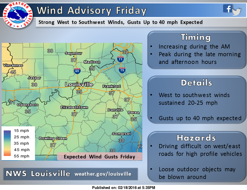
Oh yeah, and a note about the expected winds. They will be VERY gusty. Much of the region should expect south winds of 20 to 25mph, with gusts approaching 40mph at times. This could lead to some travel difficulties for larger vehicles on east to west oriented roads. It is for this reason that a Wind Advisory is in effect through tomorrow evening.
Outside of the wind, the majority of the day will be calm. Sunshine will be noted in the morning, and the warmth will be felt. We're looking at highs in the upper 60s and close to 70 for some! This is all before an increase in clouds during the afternoon and evening hours. At that point, a few sprinkles may fall headed into the overnight time frame. That's ahead of increasing rain chances by Saturday and into Sunday, but we'll have updates on that tomorrow evening.
For now, the Friday take away is sunshine in the morning that will give way to increasing clouds and a few evening sprinkles. Highs will range from roughly 65 to 70 degrees area wide. Lastly, hold on to your hats, or else the wind won't be the only thing blowing around out there.
Have a good one, and enjoy the warmth tomorrow. After all, it's mid February, and winter isn't exactly over. ;)
- Chris Reece
No comments:
Post a Comment