It certainly looks and feels like winter outside, brrrrrr!!! These brutally cold temperatures will continue into your weekend along with snow chances.
Synopsis:
A strong area of high pressure will be moving SE across the upper Midwest pushing colder air into our region this evening. The cold air remains in place for Saturday keeping our temperatures below the freezing mark. Increasing warm air aloft on Sunday will trigger light snow showers across the area while a shortwave crossing the Midwest should help to strengthen them a little.
Attention shifts toward a developing winter storm to our SW Sunday evening. A large part of the storm should stay to our south as it tracks eastward. Precipitation should stay as snow for the overnight hours Sunday with a transition to drizzle by Monday morning.

Forecast:
Tonight temperatures are expected to drop into the teens with a chance of flurries possible.
Tomorrow and tomorrow night will remain cold, with temperatures ranging only from the teens at night to mid 20s during the day.
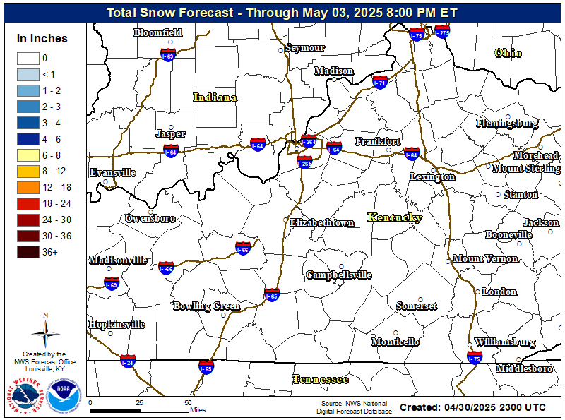
The highs for Sunday stay in the lower 30s with light snow showers developing during the day.
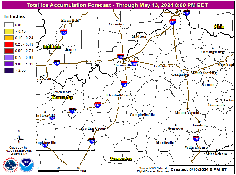
Sunday night will bring the increasing chance of snow possibly mixed with rain and freezing rain. Light accumulations of snow and ice are possible. Lows will hover around 30 degrees.
Monday highs will climb into the lower 40s across the area with rain mixing at times with snow throughout the day.
If you have to travel this weekend, be sure to exercise caution while driving as roads could become slick if they become coated with snow and ice!
Stay safe and have a great weekend!
Alex Williams
No comments:
Post a Comment